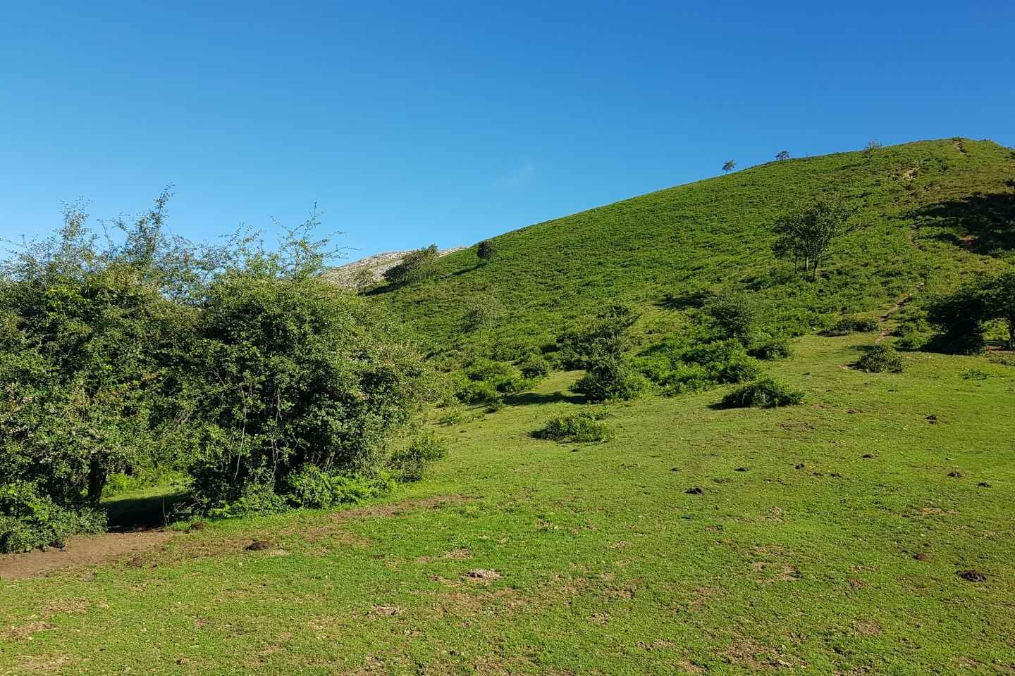
Pico La Cruz da ibilbide honen erreferentzia nagusia. 802 metroko garaiera du eta Galdamesen dago. Harkaitz-formazio bitxi batek koroatzen du gailurra. Aire-zabaleko meategiek hainbat auzo desagerrarazi zituzten, eta eskualdeko paisaiak erabat eraldatu, ezagutezin bihurtu arte. Horren lekuko izan ziren bidean aurkituko ditugun panoramika harrigarriak, gaur egun birnaturalizazio-prozesuan daudenak.
Ibilbidea bi modalitatetan egin daiteke: berdea, errazagoa, eremu teknikorik gabea eta desnibel txikiagokoa, eta gorria, hainbat tarte tekniko dituena. Edonola ere, bi ibilbideen trazadura berdina da gehien bat (tarte txikiak izan ezik, horietan aldi baterako banatzen baitira).
Bi zirkuituen epizentroa Galdamesko San Pedro plazan dago. Bata eta bestearen trazadura berdina izango da zenbait zatitan; adibidez, hasieran, Pico la Cruz, Gasterantz eta Trianoko Mendietarako (Goiuriz eta La Elvira meategia) bidean.
Bi ibilbide horiek GR 281 izeneko bidezidorrean hasten dira, eta Akendibar auzoa zeharkatzen dute. Bertan, artadi eta ermita bat nabarmentzen dira. 1874. urtean, Somorrostroko batailaren eszenatokia izan zen.
Bidezidorrean gora jarraituko dugu, metroak irabaziz, bidea osatu arte. Jarraian, bertikalean hainbat metro gainditu beharko ditugu, eta une horretan zirkuituak lehen aldiz bananduko dira. Zirkuitu gorriak tarte bertikal osoa zeharkatuko du, Gorbeiako gurutzearen miniaturazko erreplika batera iritsi arte; zirkuitu berdea, berriz, Aldape mendi-lepotik datorren bidezidorrerantz desbideratuko da (Pico la Cruz mendiaren oinetaraino iristeko aukera errazagoa).
Bi ibilbideak puntu horretan elkartuko dira berriro, eta Gasterantz ondoko basoraino jarraituko dute. Zuhaitzen artean sartuko gara, Eretzak eta Larreako mendi-lepoak (eta, haratago begiratuta, Gorobel mendilerroa) eskaintzen dizkiguten panoramikez gozatzeko.
Basotik irtengo gara, Ganeran azpitik doan bidezidor batean barrena, Giuruzera iritsi arte, eta, ondoren, Elvira meategiko meatze eta leizeen eremura.
Berriro banandu ondoren, ibilbide berdeak ezkerrera egingo du eta Laia auzoraino jaitsiko da, San Pedro plazako helmugaraino. Ibilbide gorriak, ordea, Trianoko Mendietatik jarraituko du El Saucoraino. Puntu horretan, Urallaga aldera jaisten hasiko gara. Bertan dago La Magdalena haitzulo ikusgarria.
Azkenik, eukalipto baso batean behera jarraituko dugu, La Aceña eremuraino, eta azken zatia errepidez egingo dugu (harrobiaren ondoan), ibilbidearen amaierara iritsi arte.
Pico La Cruz is the main reference. The height, 802 m and belonging to the municipality of Galladies, is crowned by a peculiar and recognizable rock formation. Mining activity has completely transformed the appearance of villages and landscapes in the region, as evidenced by the breathtaking panoramic views we will find in our wake, which is now being renaturalized.
We divided the course into two levels: the green level, which is more accessible, without technical zones and with less slope, and the red level, which has several technical sections. The two share the vast majority of the course, with small segments in which they are temporarily separated.
Both circuits will have their epicenter in the Plaza de San Pedro de Galladies and will share several common sections, such as Pico la Cruz, Gasterantz and the Montes de Triano region (Goiuriz and Mina La Elvira).
Both will set off along the path known as GR 281, passing through the Akendibar district, where you can admire its oak grove and hermitage, as well as discover a segment of the history of the Battle of Somorrostro.
We will continue to gain meters of slope along the trail until it ends. Then, we will have to travel several meters vertically, at which point the circuits split for the first time. The red circuit will cover the entire vertical section until reaching the miniature replica of the Gorbeia cross, while the green circuit will take the path that starts from Collado Aldape, which is more affordable to reach the base of Pico la Cruz.
At this point, they meet again, continuing to the forest next to Gasterantz, where we will enjoy the panoramic views offered by the Eretza and the Larrea Pass (and even, beyond, by the Sierra Salvada).
At the exit of the forest, we will continue on a small path below Ganeran, to Giuruz, then the area of the mines and chasms of Mina Elvira.
After a new separation, the green line will turn left and take the descent that will take us to the Laia district before reaching the finish line around Plaza de San Pedro Square, while the red line will continue along the road passing through Montes de Triano to Sauco. At this point, we will face the descent to Urallaga and its cave, the famous La Magdalena cave.
We will continue to gradually descend through small eucalyptus forests to the La Aceña region and we will connect a last section next to the quarry, until the end of the route.
Pico La Cruz es la principal referencia de esta ruta. El alto, de 802 metros de altitud y perteneciente al municipio de Galdames, está coronado por una peculiar y reconocible formación rocosa. La actividad minera transformó por completo la fisonomía de los pueblos y paisajes de la zona, como demuestran las sobrecogedoras panorámicas que encontraremos a nuestro paso, hoy en pleno proceso de renaturalización.
Hemos dividido la ruta en dos modalidades: la verde, más accesible, sin zonas técnicas y con menor desnivel, y la roja, que dispone de varios tramos técnicos. Ambos comparten la gran mayoría del recorrido, con pequeños tramos en los que se separan temporalmente.
Ambos circuitos tendrán su epicentro en la plaza de San Pedro de Galdames y compartirán varios tramos comunes, como son el comienzo hacia Pico la Cruz, Gasterantz y la zona de los Montes de Triano (Goiuriz y Mina La Elvira).
Los dos arrancarán a través del sendero conocido como GR 281, pasando por el barrio de Akendibar, donde se podrá apreciar y disfrutar de su encinar y ermita, así como conocer parte de la historia de la batalla de Somorrostro.
Continuaremos ganando metros de ascensión por el sendero, hasta completarlo. Acto seguido, tendremos que superar varios metros en vertical, momento en donde los circuitos hacen se separan por primera vez. El circuito rojo afrontará todo el tramo vertical hasta alcanzar la réplica en miniatura de la cruz del Gorbeia, mientras que el circuito verde se saldrá hacia el sendero que viene de Collado Aldape, más asequible para llegar hasta la base de Pico la Cruz.
En este punto se reencuentran, continuando hasta el bosque situado junto al Gasterantz, en el que nos adentraremos para disfrutar de las panorámicas que nos ofrecen el Eretza y el collado de Larrea (e incluso, mirando más allá, Sierra Salvada).
A la salida del bosque, continuaremos a través de un pequeño sendero por debajo de Ganeran, hasta alcanzar Giuruz y a continuación la zona de minas y simas de Mina Elvira.
Tras una nueva separación, el verde girará a la izquierda y tomará el descenso que nos llevará hasta el barrio de Laia antes de alcanzar la meta en el entorno de la plaza de San Pedro, mientras que el rojo continuará a través del recorrido sobre los Montes de Triano hasta Sauco. En este punto afrontaremos el descenso a Urallaga y su cueva, la conocida gruta de La Magdalena.
Seguiremos descendiendo progresivamente a través de pequeños bosques de eucalipto hasta el área de La Aceña y enlazaremos un último tramo por carretera junto a la cantera, hasta llegar al final del recorrido.
Añadir una valoración